
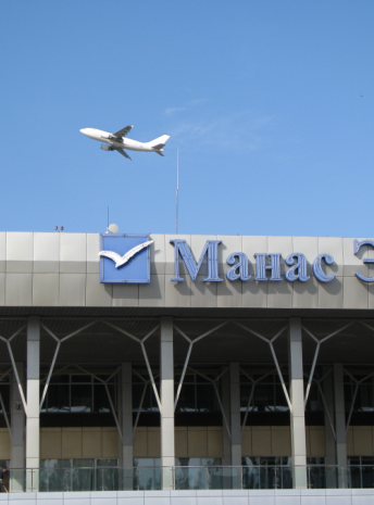
On your way
Osh KG
Osh, the second largest city of the Kyrgyz republic, is one of the oldest settlements of Central Asia. It is located in southwestern Kyrgyzstan near the Uzbekistan border in the eastern section of the Fergana Valley. This one of the Central Asia's most interesting cities because of its long history, dating back as least to the 5th century BC - its position as an important crossroads for Silk Road trade and its huge market. For centuries it was a major silk-production center, strategically situated on a trade route to India.
Sights are: the huge bazaar, Sulaimans Throne (a 200 m hill called Takht-i-Suleyman (Solomon's Throne), where the Prophet Muhammad is thought to have prayed and where Muslim pilgrims began visiting in the tenth century), Baburs House (at the top of Sulaimans Throne), several monuments (especially the one of Kurmanjan Datka – Kyrgyz feminine ruler and engaged warrior against the Russian invasion), the Russian-orthodox church, the biggest mosque of the country (situated right beside the bazaar) and the Rabat Abdul Khan Mosque (16 th century).
The population of Osh is mostly Uzbek. Osh has two universities, a sanatorium, and an airport. Economic activity has been aided by beneficial reforms and consists of the Jayma bazaar; silk trade; mining of zinc, lead, and coal; food processing; and the production of silk, cotton, and wool.
Jalal-Abad KG
Jalal-Abad (also Dzhalal-Abad; since 2003 also spelled Jalalabad and Jalalabat) is the administrative and economic center of Jalal-Abad Oblasty in southwestern Kyrgyzstan, with a population of about 75,000. It is situated at the north-eastern end of the Fergana valley along the Kugart river valley, in the foothills of the Babash Ata mountains (at 40°56′N 73°0′E), very close to the Uzbek border.
Jalalabad is known for a number of mineral springs in its surroundings, and the water from the nearby Hozret-Ayub-Paigambar spa was long believed to cure lepers. Several Soviet era sanatoria offer mineral water treatment programs for people with various chronic diseases. Bottled mineral water from the region is sold around the country and abroad.
One of the branches of the Silk Road
Jalalabad oblast covers 33,647 square kilometers in the south-west of Kyrgyzstan. Except for the small fringes of the Fergana valley, it is a land of mountains. The world's oldest and largest natural walnut forests are in the Arslanbob region of Jalalabad. A pearl of the region is the Sary-Chelek nature reserve with a beautiful alpine lake surrounded by wild fruit orchards and snow-covered peaks.
The region is a center for fruit and vegetable growing and people are engaged in producing wheat, fruits, vegetables, maize, nuts, tobacco and silk-worm cocoons. There are some light-industry plants and hydroelectric stations.
Arslanbob village KG
Arslanbob (written also Arstanpap or Arslanbap) is a wide village in the mountain, north of the city of Jalal Abad. Mainly populated by people of Uzbek ethnicity, the village count about 1500 inhabitants. Arslanbob is good place to relax after an hot journey in Uzbekistan. Mountains, waterfalls, rivers and forest are the main curiosities.
Nuts forest are legendary because there are certainly originel forest of nuts, and maybe Alexander the Great bring back these nuts to Greece.
The name of Arslanbob comes from the hero names Arstan-Baba.
NGO "Forest relics" is our lodging provider.
CBT Arslanbob KG
Coordination office of CBT Arslanbob leading by Hayat. Our local partner for trekking, horseback riding and ski touring in the region of the largest nuts forest in the world. With Hayat the coordinator of CBT Arslanbob, we are developing new routes and programs. In partnership with the Swiss NGO "Boule de neige", we are supporting winter sport access to children of Arslanbob village.
Toktogul water reservoir KG
The Toktogul hydroelectric power station, built in 1975, is the largest and most important power station in the country, producing up to 40% of its electricity. In addition, the dam of its dam produces a volume of 19 billion cubic meters of water that flows through the largest Toktogul reservoir in Central Asia and governs the irrigation and energy regimes. Visits are prohibited to the public, and entrances are monitored by the military. Access to the dam is from the small town of Kara-Kël (or Karakul, Kara-Kul, Kara-Kol).
The Toktogul hydropower plant is rightly regarded as the flagship of Kyrgyzstan's hydropower industry. The station project was developed by the Central Asian branch of the "Hydroproject" Institute. S. Ya Zhuk with the participation of Soyuzgidroproekt, Gidrostalproekt, etc. The dam is a complex construction intended to regulate the flow of the Naryn River and the production of energy in the long term.
The location of the station was chosen in the mountains of the central Tien Shan, at the entrance of the Naryn river, in the Ketmen-Tyube valley, in a narrow gorge reaching a depth of 1500 m. The slope is 65 - 70 °. The configuration of the station facilities was determined by the topographical and geological characteristics of the construction site, mainly by the seismicity, which is 9-10 points.
The hydroelectric complex includes a reservoir, a dam, two deep weirs, a surface weir, 4 turbine water pipes.
The station's reservoir is the largest in Central Asia, located in the Ketmen-Tyube valley and has the following dimensions: 65 km long, 284.3 km2 in area, maximum depth of 120 m, for a total capacity of 195 billion m3, useful - 14 billion m3.
The Toktogul Hydroelectric Power Plant Dam design parameters are a unique concrete structure designed to operate under exceptionally high seismic conditions. Its height is 215 m, its length along the ridge is 292.5 m, and the total concrete volume of the dam is 3.2 million m3.
The construction of a hydroelectric power station with a two-row arrangement of four hydraulic units is directly adjacent to the dam from downstream. PO-170/505-B-535 radial-axial turbines with a power of 307 MW each were installed in the building of the hydroelectric power station.
The turbines are supplied with water by four pressure pipes 7.5 m in diameter located in the central part of the dam.
Technical and economic indicators of the station:
* installed capacity - 1200 MkW;
* guaranteed power - 260,000 kW;
* average annual electricity production - 4,400 million kW / h;
* water flow through the turbine - 245m3 / s;
* number of hydraulic units - 4.
Kyzyl Oy KG
A small village in the heart of the Kekemeren canyon, with red rocks landscape. A nice place to start a trek or horseback riding to Suusamyr valley.
Kochkor KG
Kochkor is a town of shepherds located in Naryn oblast 200 km from Bishkek. It is located at 1800m. alt. The city has 17,000 residents. Most of them are shepherds or farmers. With the Kyrgyz hospitality, tourism is an increasingly important for economy. It is a starting point to reach the sights as Lake Song Kul, Sarala-Saz pastures, Lake Koelykoek, the salt mine Chong Tuz, and also the crossroads between Issyk Kul lake and City Naryn. Places for visiting: the women cooperative "Kochkor Kutu" which develops Kyrgyz crafts. Opportunity to see a demonstration of the production of livestock market mouton. The cattle market held each Saturday is always a colorful and lively event,don't miss it.
Issyk Kul KG
Lake Issyk Kul has a length of 182 km, a width of up to 60 km, and covers an area of 6,236 km². This makes it the second largest mountain lake in the world behind Lake Titicaca. Located at an altitude of 1,606 m, it reaches 702 m in depth. About 118 rivers and streams flow into the lake - the largest are Djyrgalan and Tyup. It is fed by springs, including many hot springs, and snow melt-off, and it has no current outlet. Its southern shore is dominated by the ruggedly beautiful Tian Shan mountain range. The lake is slightly saline and its level drops by approximately 5 cm per year.
Lake Issyk Kul was a stopover on the Silk Road, a land route for travelers from the Far East to Europe. Many historians believe that the lake was the point of origin for the Black Death that plagued Europe and Asia during the early and mid-14th century. The lake's status as a byway for travelers allowed the plague to spread across these continents via medieval merchants who unknowingly carried infested vermin along with them. A 14th century Armenian monastery was found on the northeastern shores of the lake by retracing the steps of a medieval map used by Venetian merchants on the Silk Road.
Karakol KG
At the eastern tip of Lake Issyk-Kul, Karakol is a fertile garden town of wooden chocolate-box cottages and shady, poplar-lined avenues. Fringed to the east by the Terskey Ala-Too Mountains, which tower dramatically over its low-rise skyline, Issyk-Kul ripples 10 km to the west.
Karakol is the best base from which to explore the lakeshore and Central Asia's prime trekking and mountaineering routes. With the most spectacular parts of the Central Tien-Shan right on its doorstep and newly open to foreign visitors, the town attracts trekkers, hikers and climbers from all over the world.
Karakol and its surroundings have just as much to offer their less energetic visitors. Besides one of Kyrgyzstan's largest and most colorful bazaars, a nomadic livestock market and several good museums, its spectacular environs boast an endless array of truly unique day trips. Blood-red cliffs, hot springs, Scythian burial mounds, nomad camps and sandy beaches thousands of miles from the sea are all within easy reach.
The town was build since 1869, one year after Teplokluchenka (actually name Ak-Suu). There is a unique building in the center of Karakol - ancient wooden orthodox church. But you may visit also the zoo, the regional museum, the wooden mosque, the Panfilov park, the Park Victory, the museum and memorial Prejwalski.
Despite Karakol's status as the administrative center of the Issyk-Kul region, it has only 75,000 residents and a gentle, small-town atmosphere.
Burana Tower KG
Burana Tower is seven km. far from the city of Tokmok. It is an 11th century minaret, and one of the first buildings of such type in Central Asia. The original height of minaret was 45 meters. Today the tower is 24.6 meters high, the remaining part came down during an earthquake in the 15th century. In the 10th to 12th centuries, Karakhanids khanate was a great feudal state of Central Asia and Kazakhstan.
The founders, "karakhans", chigil tribes by birth, lived in the Tien-Shan and for a short time of the second half of the 10th century they conquered a large territory. One of the capitals of this state was Balasagun. In Karakhanids' time new towns and settlements were developing, the centers of big cities were improved and Moslem religious buildings were built in the town of Balasagun. Burana tower, mausoleums and other buildings found after archeological excavations are the witnesses of that build up. The town's life declined slowly, people left it, the buildings fell apart and finally in the 15th century it ceased to exit.
Bishkek KG
Bishkek is one of the greenest cities in Central Asia. About 150 different kinds of trees and bushes are planted in the streets of the city. There are many cinemas, Opera House, Kyrgyz and Russian Drama Theater, Mosques and Orthodox churches, historical complex of the national hero - Manas- “The Manas Ailly”, zoological, geological art and other museums, exhibitions of decorative and applied art, colorful oriental bazaars are others interesting places you are invited to visit.
On bazaar one can see really traditional handiwork of Kyrgyz land and goods from all around the world at reasonable prices. There are remarkable parks and shadowy boulevards Erkindik and Molodaya Gvardia, pensioners like to walk there, sportsmen run along its alleys, kids play and young people date here.
Bishkek - capital, heart of the Kyrgyz Republic, its political, economic, scientific and cultural center, the main transport unit. Bishkek - the location of the supreme bodies of the government of republic, embassies and representations of the foreign states. Bishkek is located in the center of the Chuy valley, at bottom of snow-white mountains of Kyrgyz Ala-Too, at height of 750 m. above sea level.
The area of territory - 160 sq. km, the population - about 1 million person. The city residential areas which have arisen at various times, differ on the planning structure and a degree of an accomplishment. Last years are characterized by occurrence on adjoining to city of territory of some new buildings with the microstructure. The city on administrative-territorial division is broken into 4 areas: Leninsky, Pervomajsky, Sverdlovsky, Oktjabrsky.
In Bishkek the most part of all industry of Kyrghyzstan is located. Feature of planning structure of the city of Bishkek is development of industrial zones along the railway. In city two industrial zones are allocated: east and western. The system of transport and foot ways connects industrial and administrative areas among themselves. Gardening is submitted by squares, parkways, parks, adjoining to city the territory is planted by forest plantations, there are lakes and water pools.
The science and education are submitted by the National academy of sciences and a plenty of average special and higher educational institutions. Bishkek - the center of national culture of Kyrghyzstan. Here there are theatres, a philharmonic society, libraries, museums.
Intensively the information infrastructure of city develops: some Internet providers already work, a plenty of local, global, corporate computer networks is created. Two operators of cellular communication, some operators of a paging and trunk radio communication work.
Info
What is included
-
All transportation in a private vehicle
-
All airport transfers
-
Accommodation as described in the program
-
Meals (3 per day)
-
Bottled water & tea
-
English-speaking guide
-
All the activities listed in the program
-
Entry fees at national parks and/or border zones listed in the program
-
Entry fees at museums and historical sites listed in the program
-
Domestic flights mentioned in the program
-
A contribution to our sustainable development projects
-
Organisation of the trip & local taxes
What is not included
-
International flights
-
International banking fees (PayPal, ...)
-
Travel & repatriation insurance
-
Visas / LOI (if applicable)
-
Alcoholic and soft drinks
-
Personal expenses
-
Additional costs due to unexpected personal events (health, loss of luggage, ...)
-
Tips for guide & driver (always optional, always appreciated)