
Places to visit
Chapdara lakes TJ
Lake Chapdara or locally called Kuli Chapdara, the largest of the Alaudin Lakes (300 to 400 meters in diameter), which is part of a system consisting mainly of three large and several small lakes, connected by underground tributaries and outlets mountain waters. It is located in the Ayni region in the western part of the Gissar ridges of the Fan Mountains. They are located in the upper gorge of the Chapdara River, at the foot of the peak bearing its name and culminating at 5,049 meters above sea level.
Char Minar UZ
Chor Minor or Char Minar is also known as the Madrasah of Khalif Niyaz-kul. It is located in an alley northeast of the Lyab-i Hauz complex. It is protected as a monument of cultural heritage and is also part of the historic center of the UNESCO World Heritage Site of Bukhara. In Tajik, the name of the monument means "four minarets", in reference to the four towers of the building.
The structure was built by Khalif Niyaz-kul, a wealthy inhabitant of Bukhara of Turkmen origin in 1807 during the reign of the Manghit dynasty. The function of this building is still not very clear. The minarets were not used for the call to prayer. Originally it was part of a madrasa complex, which was demolished. The building has no analogue in Bukhara architecture, and Niyazkul's inspiration and patterns are unclear.
Charyn canyon (Sharyn) KZ
Charyn Canyon is a picturesque deep gorge in Kazakhstan, stretching for 154 km along the Charyn river valley, not far from the border with China and Kyrgyzstan. The dried up bed of the ancient river, a unique natural monument, more than 12 million years old, fascinates with its cosmic landscapes. Given the size and geological features of the Charyn Canyon, it is often referred to as the "younger brother" of one of the largest gorges of the planet: the American Grand Canyon. We can also observe a Relic Forest of ash tree. Reddish cliffs and abysses that are similar to castle towers, depths from 150 to 300 m, impress everyone who has been here. The most visited and famous is the site of the canyon, called the "Valley of Castles". Enjoy a walk along a narrow valley with fantastic-shaped walls.
It was declared a protected reserve in 1964 and today intagrated in the Charyn National Park.
Chashma-Ayub Mausoleum UZ
Chashma-Ayub Mausoleum is located near the Samani Mausoleum, in Bukhara, Uzbekistan. Its name means Job's well, due to the legend in which Ayub visited this place and made a well by striking the ground with his staff. The water of this well is still pure and is considered healing.
Chatkal valley KG
The Chatkal valley follows the mountain chain of the same name, to the north-west of this chain, over a length of 160km before flowing into the Charvak dam in Uzbekistan. By road, there are only 2 accesses, either by Talas to the north and the Kara-Bura Ashuu pass located at 3302m. alt .; or from the south, via the Chapchyma Ashuu pass 2841m. alt. when arriving from the town of Kerben.
The capital is the village of Kanysh-Kyya, and the lower part of the valley is in the Besh-Aral nature reserve.
The Chatkal river is one of the most beautiful rivers for rafting, on the other hand tourist infrastructures are still very rare there.
On the other hand, the mineral resources are important there: lead, silver, zinc, antimony and building materials.
The natural parks located to the north and northwest of the valley benefit several species. The fauna is very particular and rich in the mountains. In the forests, among the wild fruit trees and bushes, live wild boars, foxes, bears, sometimes deer. The porcupine, the badger, the forest dormouse live in forest areas. The marten, sometimes the ermine and the weasel huddle near the rocks. High in the mountains graze Siberian goats, which are hunted by snow leopards. Groundhogs are everywhere. But above all there are a lot of birds here. The deciduous forests are rich in starlings, orioles, blackbirds, woodpeckers, goldfinches and nightingales. Magpies, coarse juniper, finches, mountain buntings live in juniper forests. On the rocks and the steep slopes nest doves, swifts and many birds of prey: vulture, kestrel, vulture, golden eagle and others. And stone placers are favorite places for partridges and grouse. Three types of fish are commonly found in mountain rivers: common marinka, Amu-Darya char, and Turkestan catfish.
Chatyr-Kul lake KG
Chatyr-Kul lake is an endorheic lake on the south-western side of the At-Bashi range in the district of Naryn Province. On the south, the road linking Bishkek to Kashgar runs alongside the lake and exceptional mineral water sources. But it is above all the summer habitat of many species of migratory birds. The name of the lake means “Celestial Lake” in Kyrgyz (literally "Roof Lake"). The lake and around it is part of the Karatal-Japyryk State Nature Reserve. The lake is a Ramsar site of globally significant biodiversity. To access to the lake, you need a special border permit.
Chengde CN
Take a visit to an emperor’s summer resort.
Chengdu CN
Chengdu Shuangliu International Airport CN
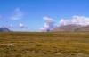
Chichaklik CN
Campsite on pasture at the foot of the Yanguo pass
Chinggis MN
Chinggis Khaan International Airport MN
The International airport of Ulaanbaatar (Ulan Bator) link different cities like Berlin, Frankfurt, Seoul, Bejing, Hong Kong, Tokyo, Moscow or Istanbul. It situated 35 min. from the center of the capital of Mongolia.
Choibalsan MN
Choibalsan Airport MN
Choibalsan Airport COQ is a civil airport located in NE of the town of Choibalsan, the capital of Dornod Province in East Mongolia. Hunnu Air operates flights to Ulan Bator, to Manzhulli and to Hailar. A one way ticket for Ulan Bator cost around 80-100$.
Choir MN
Chokoly lakes KG
Chokoly lakes or Chokolykel are a group of a dozen of lakes on the South side of the Juku pass. Only the big lake on the east side have a river flowing into the Arabel Suu river. The largest lake is about 3km long.
Choloktor valley KG
Wide plateau with numerous lakes, surrounded by incredible red and black mountains part of the 5000 meters Ak-Shirak range.
Cholpon-Ata KG
The city of Cholpon Ata is located on the northern shore of Lake Issyk Kul, 265 km east of Bishkek. There are about 11 000 inhabitants.
The city is known for its sandy beach, seaside resorts and hosts many tourists in the summer. Tourists come mainly from countries of the former USSR.
Many hotels, guest houses and apartments are open throughout the summer. Also, you will find animated streets ...
Things to see: The petroglyphs, the museum Rukh Ordo, the Regional Museum Cholpon Ata.
Chong Kemin KG
Ski backcountry with horses in the National parc. Winter in Chon Kemin is also great for snowshoeing and horseriding.
Chong Kemin KG
The population of Chong Kemin is devided in 6 small villages. Novorossiika is the main one with Town hall, hospital and school. Others one are Tegirmenti, Tar Suu, Kalmak-Ashuu, Kaïndy and Karool-Debe where are situated our homestays.
Chong Kemin National Park KG
This park encompasses the entire Chong Kemin Valley. There are many trails still virgin or almost. Several passes between Issyk Kul Lake or Kitchi Kemin Valley.
The total area is 126,514 hectares. Here in the park the river Chon Kemin flows. More than 780 species of plants grow and rare mammals such as snow leopard, brown bear, maral, Eurasian lynx, golden eagle, himalayan griffon vulture (Gyps himalayensis), bearded vulture (Gypaetus barbatus), saker falcon and sablefly are found.
Chong Kemin river KG
The Chong Kemin River (Kyrgyz: Чоң Кемин дарыясы) is a main river in Kemin District of Chuy Province of Kyrgyzstan. It is rising in the Zailiiski range (marking the border beetween Kazakshtan and Kyrgyzstan) and the Kungey range, and is a right tributary of the Chu River in Boom Gorge. The river is protected by status of the National park of Chong Kemin.
It has a length of 116 kilometres with a basin area of 1,890 square kilometres.
The Chong Kemin river rises as an effluent of the Murok Suu, the Sapojnikova, the Mashkovtseva, the Keminski, the West Ak-Suu, Dolon Ata, North Cholpon Ata and others glaciers of the Kungey range.
It receives the water from many rivers like Utsh Bulak river, Tegirmenti Suu, Kashka Suu (Kekoyrok mount), Tshetyndy, Ishke-Suu, Djan-Aryk, Buzulgan-Say, Kaskeleng, Djaya, Bashy-Djaya, Sek-Archa-Bulak, Chong Ak-Say, Kokuy Bulak, Almaty, Tuyuk Almaty, Koel Almaty, Kashka Suu (Zailiiski range), West Ak-Suu, Dolon Ata, North Cholpon Ata, Tertyuktshyu-Koy-Suu, Chong Koy-Suu, Orto-Koy-Suu, Koy-Suu, Djindi-Suu, Utsh-Emshek, Kashka-Suu (Dzore mount), Diure, Koel-Ter, Toru-Aigyr, Shymbulak, Ortokaindy, Cholakaindy, Kalmak-Ashuu and Tar-Suu rivers.
In the bassin of the Chong Kemin river, there are some lakes like Koel Kongur, Djashyl Koel, Djacyl Koel, Almaty, and many small glacier's lakes.
It's a good place for fishing the Amurdaria trout, Issykulski trout and the Chuy Osman.
The river also offer on its lower part a good opportunity to try rafting on a 23 km long from class II to IV, starting a bit lower than the Shabdan village till Djil Aryk village on the shore of the Chuy river. (see our rafting programs).
Chong Kyzyl Suu meteo station KG
The geophysical station in the valley of Chong Kyzyl-Suu was built in 1948 by Germans, who have been captured in Kyrgyzstan. At that time, there was no way for cars to get to the station, so they had to transport all building materials on camels.
The purpose of the station was already then to observe the glaciers, mountains and the animal world. There worked hydrologists and geomorphologists from many different nations.
During the Sowjetunion many students from Moscow and St. Petersburg came here to get some practice and to write their graduation work. A lot of people got their doctor title due to this station.
Until 1991 there were many geographical expeditions, but for example also expeditions to observe the life of snow leopards.
From 1991 to 2003 it was a kind of a geological institute. In 2007 it got an institute for water problems as well as a hydro-energetic institute.
Until the year 2007 it was being named physical-geographical station, but then it got a new name: tien-shan high-alpine scientific center.
Today they work together with Chinese, American and French scientists. Its current director is Satilkanov Risbek Ablaievic.
Since 2003 they started to work with tourists as well. But even earlier, there have been tourist visiting the station. For tourists it’s got interesting things to see in a wonderful environment, where you do beautiful hikes to lovely lakes. The station has places for 18 people at a time. The inhabitants are very kind, but the life there is without luxury. (No current water, no electricity, outdoor toilet)
Transports can be organized from Djety Oguz, Bischkek, Karakol, Sjrtju Bulak or Djukku.
Join us on Facebook!
And keep updated with our tour promotions, or follow us on
Instagram Twitter YouTube Linkedin